Geological Mapping
Geologic Symbols and Map Standards
-
ArcGIS Geological Symbol PackDownload and add to ArcGIS Pro to gain access to important standardized geologic symbols such as: strike and dip markers, rock types, fault lines, etc.
-
Labeling Strike and DipHow to symbolize strike and dip based on symbol rotation.
-
Geologic Mapping StandardsAn extended list of data formatting, cartography standards, terminologies, and tools needed to create standardized geologic maps.
Geologic Cross Sections
There are many ways to make digital geologic cross sections - most of which are more difficult than doing it by hand in Adobe Illustrator or similar software.
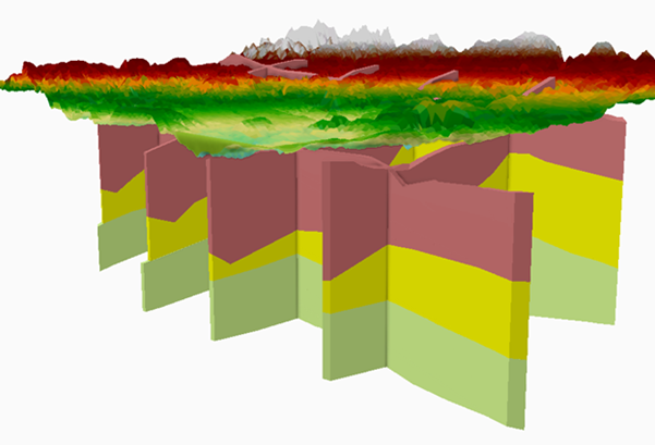
ArcGIS Pro, QGIS, and other GIS software applications can create some interesting visualizations using 3D layers and digital elevation data - but it can be difficult to get the data to do exactly what you want.
Additionally, there are a number of independent software or paid-for add-ons that may make your work easier - we just don't have access to them through the library!
-
InkscapeFree software for vector drawing, alternative to Adobe Illustrator. Has some limitations and can crash, but easy to use and less complex than illustrator.
-
Subsurface & Geological Features in ArcGIS ProWebsite shows some examples of the subsurface and 3D visualizations you can create with base ArcGIS Pro.
It can be complicated so please email a librarian if you need help! -
Elevation Profiles in QGISUses Digital Elevation Models and QGIS to get a Elevation Profile map in just a few clicks!
-
ArcGIS Interactive Elevation ProfileCreate an interactive elevation profile with just a line and a few clicks!
Datasets
-
GS Alabama Geologic DataIncludes geologic shapefiles and data for various topo quads in Alabama.
-
USGS & NASA Planetary Geologic Mapping HubIncludes maps and datasets for planets and moons in our solar system (and beyond!).